Google Maps Case Study By Farnoosh Bagheri
Improving navigation trust in unfamiliar areas for tourists on Google Maps through personalized directions, visual clarity, and real-time updates
A UX case study exploring the key reasons behind the challenges Google Maps users face when navigating new cities, and how simplification of layout, enhancing visual hierarchy, and providing instant feedback improve travel experiences and reduce reliance on third-party apps.
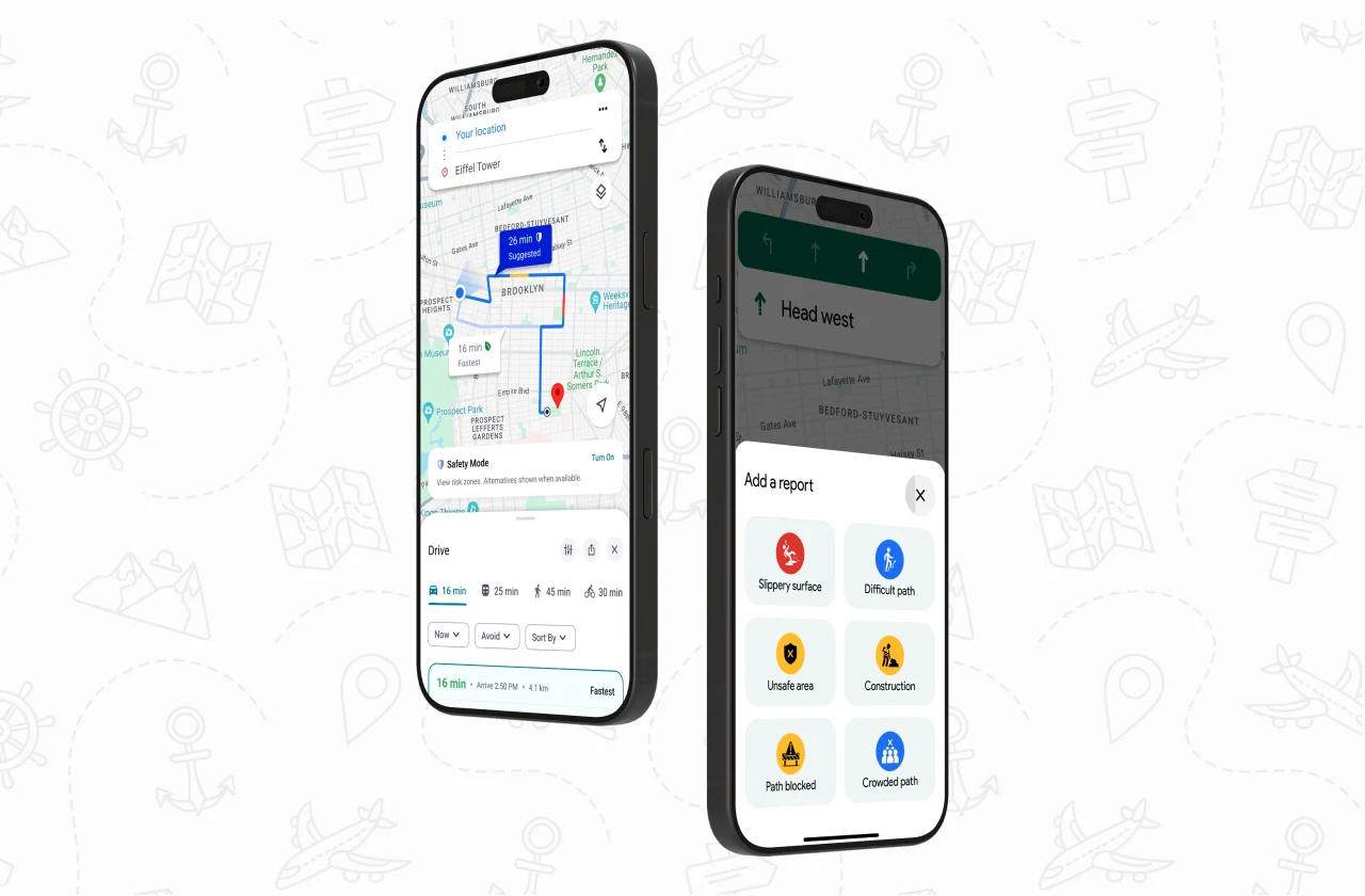
Case Study Scope
Methods
- Desk Research
- Interviews, Insights
- Persona Profile
- Competitive Analysis
- Ideation, Prioritizations Matrix
- Sketching Ideas
- Wireframe, UI
Objectives
- Improving Route Clarity
- End-to-end Trip Planning
- Adding Safety Features
- Real-time Feedback
- Explorer Walk Mode
- Enabling Tourist Discovery Mode
- Team
- 2 Product designers
- Role
- UX Researcher, UI Designer
- Duration
- 4 Weeks (Remote)
- Tools
- Figma, FigJam, Google Meet
Problem Discovery
Misrouting that creates many challenges and sometimes dangerous!
Tourists using Google Maps often struggle with navigation, especially when trying to find key attractions or local transit options in unfamiliar cities. The app’s interface is not optimized for non-local users, leading to confusion and reliance on third-party guides.
Findings on inaccurate route planning for private car users:
In 2022, a father died after Google Maps directed him onto a bridge that had been collapsed for 9 years. His family is now suing Google for failing to update the map, despite receiving prior warnings.
In 2024, two tourists trusted Google Maps into a closed, dangerous road in the Australian wilderness, forcing them to survive for over a week after their car got stuck.
Some users struggled to discover fun, unique local spots through Google Maps, saying the “Explore” tab mostly shows restaurants and lacks filters for hangout-friendly locations.


Key insights from desk research:
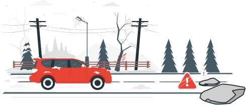
Routing Without Real-World Awareness
Ignoring real-world conditions and outdated guidance from Google Maps can direct tourists into unsafe, dead-end, restricted, or dangerous areas, resulting in confusion, risk, and the potential for serious consequences.
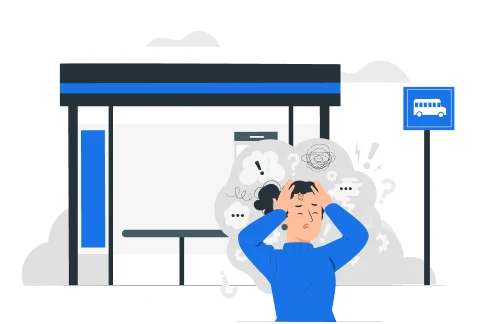
Missing Real-Time Transit Data
The lack of up-to-date public transportation information, such as schedules, disrupts tourists’ trip planning, misleads users, and gradually erodes their trust in the app.
- insight-labels.webp244×169
Mismatch in Names and Labels
Inconsistencies between real-world names and labels displayed on Google Maps can cause difficulties and navigation errors for tourists, leading to wasted time, effort, and getting lost.
- insight-attractions.webp244×169
Limitations in Attractions Discovery
Finding diverse local tourist attractions beyond restaurant and coffee shop labels on Google Maps can be challenging, and information such as opening and closing times is often inaccurate, which can lead to user frustration.
Interview
“I missed my flight after taking a scary route to the bus station because the bus arrival time was wrong!”
We continued our research by interviewing 8 individuals who had experience using Google Maps for finding key tourist attractions and navigation during their travels. The participants' feedback sparked many data and findings, and we’ll highlight the most important insights below.

Inaccurate Route Guidance
Google Maps' delayed alerts and inaccurate exit displays often cause users to miss turns, increasing the risk of accidents and route deviations. As a result, many switch to more reliable, often localized, navigation apps.
Outdated & incomplete places overview
Outdated or incomplete information like incorrect hours, closures, limited images, or unreliable ratings makes users hesitant to rely on Google Maps for exploration. They often turn to social media for confirmation, reducing the app’s effectiveness and leading to missed engagement and sales for businesses.
Unreliable Public Transit Info
Inaccurate or outdated public transport data like schedules, station details, or inactive lines can confuse tourists, leading to missed trips and a frustrating experience.
Unsafe Navigation
Google Maps' focus on the fastest route can lead users through unsafe or inefficient paths, especially in unfamiliar areas. This lack of safety awareness affects trust particularly among solo travelers and women causing them to rely on intuition or locals instead.
No indoor navigation coverage
In indoor places such as shopping malls, transportation terminals, airports, or museums, users may experience limited GPS coverage or signal disruptions, making accurate navigation challenging. As a result, they may spend additional time finding their way, rely on photos of indoor maps, or use printed maps as alternatives.
5 important insights from Users’ Interviews
But, we made a mistake that led to learning & growth
Every product is influenced by its context, including data availability, technical feasibility, and ethical considerations. While designing features, we encountered real-world limitations that challenged our design approach.
Challenges and Constraints
During desk research, we focused primarily on Google Maps’ most visible and commonly used services, as the issues we identified were related to them. Even after the interviews, we assumed the platform had only a limited set of core features. As a result, many of our initial ideas aimed to add missing functionalities, unaware that several already existed but were difficult to discover. This lack of discoverability and visibility led to some redundant ideas and ultimately required us to restart the ideation process.
We also encountered data limitations. Features such as public transportation details, 360-degree views, and similar services were unavailable in some regions due to local constraints and regulations, leading to an incomplete user experience. For example, one user complained about missing train schedules, though the issue was specific to their region and worked correctly elsewhere. These inconsistencies affected the accuracy of our interview data, requiring follow-ups to verify information and make smarter and more reliable decisions.
Persona profile
Staying close to our users
By analyzing user interviews, we created two key archetypes to keep our users top of mind at every step. They’ve been with us throughout the project, helping us stay focused on who we’re designing for and making sure our decisions truly match their needs and goals.
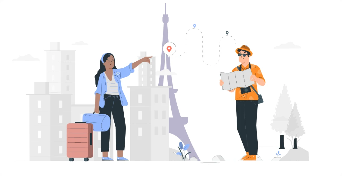
The Trip Planner
She enjoys planning her trips in detail and having accurate, reliable, and real-time information before traveling. She cross-checks multiple sources to avoid getting lost or disrupting the journey, with a well-structured, focused, and optimized approach. She uses multiple types of transportation for efficiency and cost savings. Digital tools help her stay organized with minimal local interaction.
My goal is to stay in control about tourist spots and public transportation. I use public transit, taxis, and walk and I verify information before traveling to ensure a safe and reliable trip.
The Explorer
He seeks new experiences in adventurous and lesser-known places. He needs accurate information with clear, real-time navigation to avoid going off-route or encountering challenging paths, ensuring his journey is fast and efficient. He doesn’t want to worry about places being closed or relocated. While cost is not a primary concern, he uses alternative apps for effortless driving navigation.
My goal is to explore new cities freely, without a fixed plan to discover nearby attractions. I travel by private car, bicycle, or on foot in unfamiliar areas and prefer the shortest and fastest routes.
Gaps, Gains and Growth
Google Maps is a leading navigation platform among competitors, but warnings for potentially unsafe or suspicious routes represent a gap that could turn into an opportunity
We learned that the trend is moving toward increased user interaction, real-time feedback and updates, and improved transparency and clarity in presenting information about routes, places, and other services, all contributing to a smarter, more organized, and integrated travel experience.
 Apple Maps Apple Maps |  Waze Waze |  Citymapper Citymapper |  KakaoMap KakaoMap |  Maps.me Maps.me |  Neshan Neshan | |
|---|---|---|---|---|---|---|
| User Reports&Real-time Feedback | Apple Maps — supported | Waze — supported | Citymapper — supported | KakaoMap — not supported | Maps.me — not supported | Neshan — supported |
| Turn-by-turn Directions&Lane Information | Apple Maps — not supported | Waze — supported | Citymapper — not supported | KakaoMap — not supported | Maps.me — not supported | Neshan — supported |
| Auto Zoom-inbased onDriving Speed | Apple Maps — not supported | Waze — supported | Citymapper — not supported | KakaoMap — not supported | Maps.me — not supported | Neshan — not supported |
| Route OptionsSeparately | Apple Maps — supported | Waze — supported | Citymapper — not supported | KakaoMap — not supported | Maps.me — not supported | Neshan — not supported |
| Step-free Routes &Shorter WalkingDistances | Apple Maps — not supported | Waze — not supported | Citymapper — supported | KakaoMap — not supported | Maps.me — supported | Neshan — not supported |
| Other Users Navigatingin Real-Time | Apple Maps — not supported | Waze — supported | Citymapper — not supported | KakaoMap — not supported | Maps.me — not supported | Neshan — not supported |
| Child-safe routing | Apple Maps — not supported | Waze — not supported | Citymapper — not supported | KakaoMap — supported | Maps.me — not supported | Neshan — not supported |
| Live train tracking | Apple Maps — not supported | Waze — not supported | Citymapper — supported | KakaoMap — supported | Maps.me — not supported | Neshan — not supported |
By analyzing Google Maps’ competitors, we identified potential opportunities for improvement and discovered largely untapped areas that present new possibilities for innovation. Features such as safety alerts for routes, end-to-end trip planning, context-aware suggestions based on user needs, real-time feedback beyond driving navigation, and tools that support free walking exploration represent promising directions for expanding its capabilities.
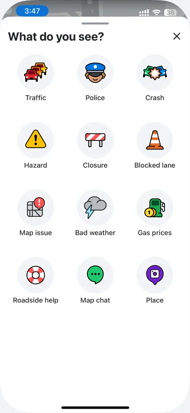
Waze
Real-time feedback
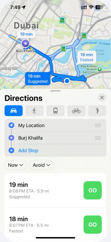
Apple Maps
Displaying routes list with details separately
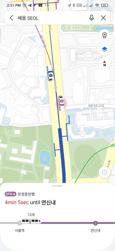
KakaoMap
Real-time transit information
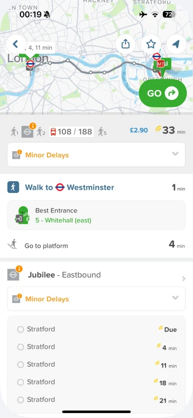
Citymapper
Display public transport delays and multiple route options
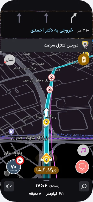
Neshan
Lane exit guide, Road signs & Speed control
Impact-Effort Matrix
Finding a balanced solution to make a more efficient change
During the ideation phase, we realized that most navigation apps focus solely on providing directions to a destination, without addressing essential features for tourists such as safe route options, discovering new places, or smart trip planning. As a result, we focused on designing features like a “Tourist Mode,” route safety comparisons, and smart planning based on user behavior. These ideas were implemented with an emphasis on feasibility and ease of integration into the existing Google Maps interface.
- Route Guidance
- Safety-related
- Places Overview
- Public Transit
- Indoor Coverage
Visual Design
From clues to sketches, a challenging process to understand how practical ideas are and to minimize user frustrations
While quick visual comprehension is generally beneficial, it becomes especially important during navigation due to the need for rapid response. This motivated us to look for design patterns that reduce complexity and make it easier to understand, even displaying a large amount of information. As a result, we focused on navigating Google Maps’ UI design patterns and implementing small yet impactful changes.
1Separated Route Details Based on Different Criteria (Fastest, Safest, etc.):
2Lane Display & Real-Time User Feedback:
3Feedback from users upon arrival:
4In progress....
Success Metric
Did our features truly drive impact? Imagine we’re part of the Google team evaluating a design’s success
We will measure the following factors:
Safety Analysis
We will monitor the frequency of 'unsafe' reports for routes previously marked as safe. A reduction in these reports may indicate improved user trust and perceived safety during navigation.
Exit Misses & Re-Routing Frequency
By tracking how often users are re-routed or prompted with new directions, we will evaluate whether users will continue to miss exits, an indicator of guidance clarity.
Incident Detection via Stop Patterns
Sudden or prolonged stops along a route will be monitored as potential indicators of incidents. We will assess whether early warnings and improved guidance contribute to reducing these occurrences.
User Feedback Analysis
To evaluate routing effectiveness, we will examine post-routing feedback to determine which suggested routes users selected in cases of reported satisfaction versus dissatisfaction. When explicit feedback is unavailable, we will analyze historical route selection patterns to infer user preferences under similar conditions.
Tourist Trip Planning Behavior
We will also explore how tourists plan and use their trips:
– Do they plan ahead or in real time during travel?
– Do they share their plans with others?
– Do they prefer wandering freely, visiting less structured locations, or following popular, frequently used paths?
Project Takeaways
Each design decision on the web can directly influence user behavior in the real world
This project helped me think critically that even the smallest design decisions can influence users’ real-life decisions, actions, and emotions, especially for tourists in unfamiliar environments.
Social impact of design decisions
Labeling areas as unsafe can raise ethical concerns and lead to social consequences, such as reduced foot traffic and potentially increased crime. Using more neutral terms may help prevent negative bias.
Decisions should be left to users
Tourists do not always prioritize early arrival; many prefer to arrive later if it ensures their safety and a positive experience. As visitors are unfamiliar with the city, negative experiences caused by navigation apps can negatively impact their overall perception of the city, reduce trust, cause stress or fear.
Discoverability is key to engagement
Having a wide range of features is useful, but their discoverability and visibility play a key role. When features are easy to notice, users are more likely to engage with them, which can lead to greater overall effectiveness.
Valuing feedback builds trust
When users see that their feedback is valued and directly influences the app’s performance, they are more likely to contribute real-time information about routes, tourist attractions, public transportation, etc. This increases tourists’ trust in the information provided and reduces the need to verify it through other apps.
That’s it! I really appreciate the time you spent
We would like to thank 🪄 Marzie Nadali (UX Leader turned Entrepreneur)
for being our mentor and helping us implement this case study.
July 2025